


The shape of today’s world map owes much to ancient explorers, political revolutions, and technological advancements. From the Imago Mundi clay tablet of Babylon to post-World War II visions of a new world order, maps have chronicled not just geography, but history, ambition, and imagination.
BulletsIn
• 500 BCE: Babylonian Imago Mundi clay tablet created, depicting the world in concentric circles.
• 2nd century CE: Ptolemy introduced latitude and longitude, revolutionizing geographical accuracy.
• 1050: Spanish monk Beatus of Liébana created a biblical T-and-O map centered around civilisation.
• 1154: Muhammad al-Idrisi crafted Tabula Rogeriana with south at the top, using traveller accounts.
• 1375: Catalan Atlas by Abraham Cresques mapped Europe and Asia, inspired by Marco Polo’s journeys.
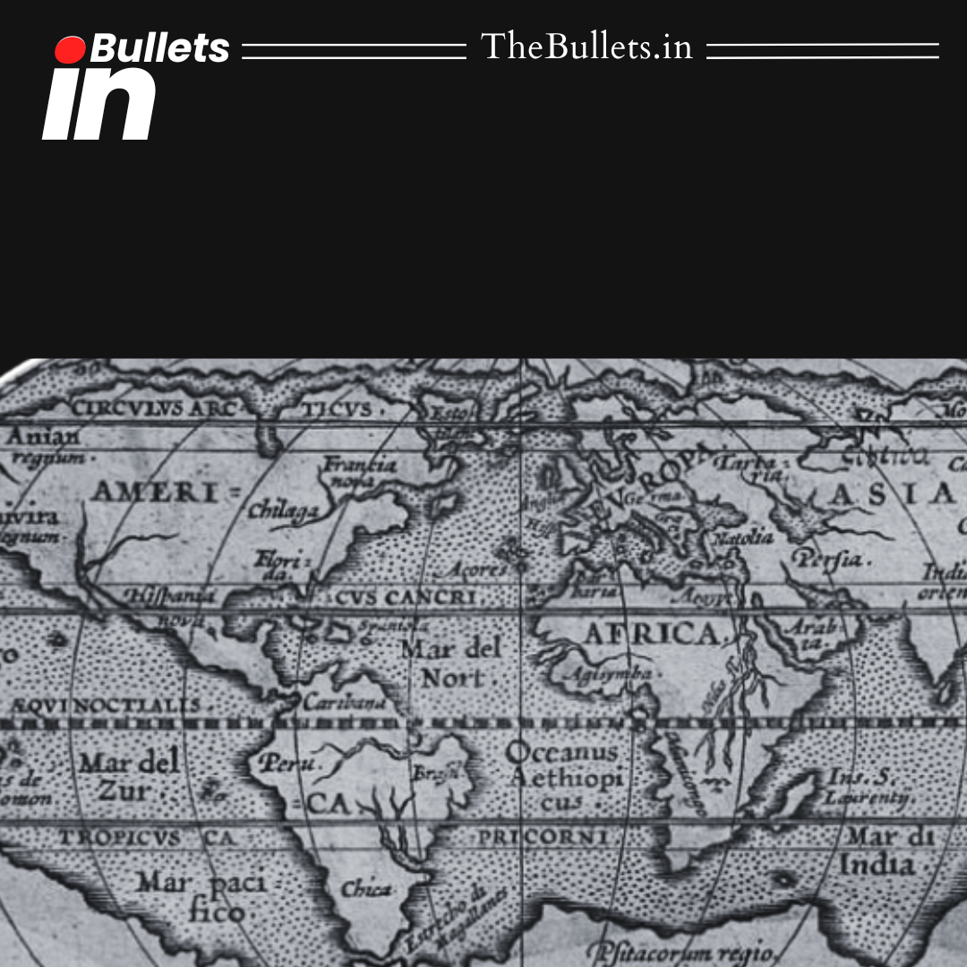
• 1599: Edward Wright perfected the Mercator projection, vital for maritime navigation.
• 18th–19th centuries: Marine chronometer enabled precise longitude measurement, boosting map accuracy.
• Post-WWI: German maps critiqued the Treaty of Versailles and self-determination hypocrisy.
• 1942: Maurice Gomberg’s map visualized America’s post-WWII global leadership vision.
• 20th century: British Empire and German cartographers led scientific advancements, shaping modern cartography.


What do you think?
It is nice to know your opinion. Leave a comment.